Sunday, August 30, 2015

A few pictures while I wait in the Airport

I am currently waiting in the LAX airport on my way back to Cupertino so I figured I'd share a few pictures from the second half of our trip.

Gzira harbor as I walked to help Api and Chris test the AUV from the shore Thursday morning.

Chris and Api working on ballasting the AUV in the Sliema harbor.

Ian and Api taking pictures of the beautiful view from the walls of Mdina on our cultural trip Thursday night.

The whole group in Mdina, a beautiful city with a rich history.  

 The AUV Friday morning as we waited to board the Russian vessel.

The view from Valletta's Saluting Battery on our last night in Malta.

The group minus Zoë in Valletta.

View from the Valletta to Silema ferry.

Ian and I headed home early Sunday morning. 

I am working on creating a mesh from the Russian boat’s sonar data using point cloud library, an open source tool, while Ian processes the video data and uses photogrammetry to create 3D models. We will post our results soon!


I had an amazing time in Malta and learned so much. We did not collect as much of our own shipwreck data as we would have liked to but we learned tons of information that will be valuable for future ICEX trips. I would have loved to stay longer but am excited to be back to my friends and family. Thank you to Zoë, Chris, Timmy, the Finnish divers, the Russian sailors, and everyone else who made this trip possible!

Friday, August 28, 2015

Having gotten the AUV to dive successfully at the test site yesterday, we were excited to return to the site of the wreck of the HMS Stubborn submarine today. We again got on the research vessel "U Boat Navigator" to spend a day out above the wreck.
The U Boat Navigator was again our workspace for the day.

Mounting the sonar on the AUV to prepare for missions.

Before running a mission to collect data on the wreck, we first tested deeper dives of depths around 8 meters. Unfortunately, we quickly saw that the AUV had trouble staying under the water and completing its dives at the depths we wanted. Throughout most of the morning and afternoon, we tried to figure out why this was.

Chris swimming after the diving robot to observe its behavior.

Meanwhile, Zoe and Ian worked on processing multibeam sonar data gathered by the research vessel.

After a long day of searching for the cause of the diving problems, we finally found it. The altimeter on the AUV often received incorrect, very low measurements. This would confuse the AUV into thinking it was about the crash into the seafloor and immediately abort the dive to avoid the crash. We turned off this crash avoidance setting and redeployed the AUV, and it finally dove as desired!

It was late in the day and we didn't have too much power left in the batteries but we were able to send the AUV on a couple lawnmower pattern missions above the wreck at a depth of 20-30m. We still have to process the sonar data from these missions but initial previews suggest we did get an (admittedly noisy) image of the submarine!

Enjoying the top deck of the boat while waiting for the AUV to complete its autonomous data collection.
A plot of the AUV's trajectory, going from blue toward red.

Thursday, August 27, 2015

Video of successful IVER dive at the test site


Test deployments in the harbor were successful this morning. After calibrating the compass, adding our large control surfaces to the AUV, and rebalasting, Api and Katie successfully deployed the AUV for several missions.

Api is shown here deploying the AUV at our test site. It is difficult to see the AUV in the water. The city of Valetta can be seen in the background.

Some pictures from our first few days in Malta

Waiting for the taxi to our first deployment, outside our apartment
Mission planning for the IVER
Chris and Api testing the buoyancy of the IVER
On the top deck of the research vessel
Api and Katie driving the IVER into position
Testing IVER diving
Watching the IVER navigate autonomously

Wednesday, August 26, 2015

Day 2 - first day on the water

We spent today on a boat working with the AUV and ROV getting them up and running and working on some kinks in the hardware.  We learned a ton about the working environment, challenges and beauty of the ocean here.  We very much appreciate the amazing hosting we had on board (thank you to our amazing Russian hosts!) We will post more about our technical work soon, but here are some images of the working environment and hard working team.
We spent the day on the boat visible in the background - very lovely!
The view looking back toward Malta from St. Paul's bay.

Api working on setting up the IVER.

Chris and Api keeping an eye on the IVER as it executes a test mission.

Chris and Api debugging the IVER tail.


The tiny videoray compared to our host's ROV

Katie deploying the ROV

off it goes!
Ian and Katie looking happy that the little video ray made it down to over 48 meters to reach the sea floor with great visibility.


Enjoying our beautiful work environment!


Tuesday, August 25, 2015

Inspiring imagery

Timmy and the Finnish divers, Emmi and Kari, have been gathering data via diving today.  We look forward "seeing" this tomorrow via the AUV and ROV!

First day in Malta

We've had a very productive first day orienting to Malta and meeting with our international collaborators.
Seeing some of the data that the Finnish divers, Immi Wallin and Kari Hyttinen, have acquired in the IT faculty building at the University of Malta (thanks Matthew!)

Immi, Api, Chris, Matthew Montebello,Timmy, Kari, Katie and Ian

On the campus of the University of Malta discussing marine archeology with Immi (specifically methods for removing silt from ship wrecks for mapping)

Timmy showing us an amphora removed from a Phoenician wreck (http://www.sci-news.com/archaeology/science-phoenician-shipwreck-malta-02118.html)

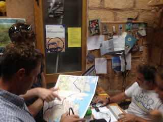
Planning in Timmy's office.

And the AUV finally cleared customs so Chris and Api could replace the batteries and get it ready for missions tomorrow.


Meanwhile, Katie and Ian worked testing Agisoft to reconstruct a 3D scene from still images using photogrammetry.


Travels to Malta

We've made it to Malta! It was a long 24 hours of travel but we didn't run into any major problems. I had a scare at the SFO airport when my terminal was closed due to a security threat and I heard all flights were grounded. I was sent to another terminal with a huge security line, but I made it through the line in time and my flight left only half an hour late.
View of San Francisco Bay from my flight
I met Zoë and Ian at LAX and we got the four suitcases containing the ROV and tools checked for the flight. We had a long flight to Zurich and made it to Malta right as the sun was setting.

My first view of Malta! 
We were relieved to see someone at the airport waiting with our names on signs. After we made it to our apartment, the three of us went on a walk to the harbor. We came back to our apartment to find Chris and Api and all headed to bed exhausted.

Sunday, August 23, 2015


Hi! I'm Katie, a Computer Science major at Cal Poly about to start my fifth year. Unlike everyone else, I haven't been involved with ICEX before, so I don't really know what I'm getting myself into. But I'm excited to find out! I'll be working on data visualization and generally making myself useful.

Zoë originally approached my about this project a year and a half ago and I can't believe it's actually happening. I've been reading the blog from ICEX 2013 to try and prepare myself. I've never been to Europe so I'm stoked to see Malta and get involved with this research. My bags are packed and I leave for the airport in an hour. See you soon Malta! 


Hello!

Hello! My name is Ian and I'm a student from Cal Poly. My goals for the week are to work on visualization software, acquire GIS and bathymetry data from Timmy, and see whether underwater video is sufficient to do SfM 3D reconstructions.

I'll also be taking an annoying number of photos and videos of the deployments. Assuming a reliable internet connection, I'll be posting a lot of those here!

If I have to be honest, my ulterior motive is to go to St. George's cave, tie a rock to the ROV, see what's at the bottom. The depths are calling.

Saturday, August 22, 2015

Hi! My name is Apoorva, and I'm part of the LAIR at Harvey Mudd. This summer, I've been working with Chris Clark on AUV path planning for efficient mapping.

As Chris alluded to in his earlier post, sonar imagery works kind of like shining a flashlight in a dark room - while objects in the room do light up and become visible, they do cast shadows, which may obscure details behind them. What this means is that when collecting sonar data, you need imagery from different vantage points to get a complete picture.

I've been developing a system by which the AUV can look at the images it has collected, figure out where the unknown areas are, and compute the vantage points that will fill in these gaps. The robot can then plan its path around these vantage points to efficiently map the environment.

The majority of this work has being done in simulation so far, but I'm looking forward to testing the system in the field in Malta!


Apoorva Sharma
Harvey Mudd College
Engineering '16


Our preliminary work at Catalina Island has shown we have been able to integrate a BlueView 2D imaging sonar with our Iver2 AUV. The image below shows the AUV diving on a mission to map out a local shipwreck.


The missions have been successful, and we have been working mapping them with standard mapping algorithms and filters (e.g. Kalman Filtering). One partially constructed map is shown below. The light green line depicts the AUV trajectory. Dark blue areas are not observed due to the sonar being side mounted and limited in beam width. The wreck can be seen coming through from the bottom left scans that have been fused within elevation map. Acoustic shadows are clearly visible, indicating the need for multiple points of sensor vantage points, (and hence intelligent planning).


Friday, August 21, 2015

Welcome to ICEX 2015! This year we plan to test our AUV (Autonomous Underwater Vehicle) shipwreck mapping system and collect preliminary data sets while in Malta. In particular, we hope to characterize our 2D imaging sonar measurements and construct our first maps of Maltese wrecks.
We hope to post results and findings throughout the next week, so feel free to follow us.


Chris Clark, Director of the Lab for Autonomous and Intelligent Robotics, Harvey Mudd College.